
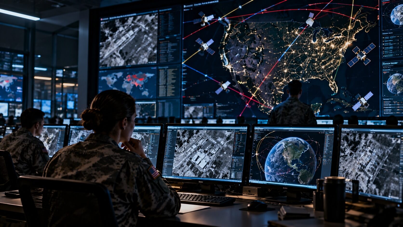
Yes, Russia operates reconnaissance satellites capable of observing the United States from orbit. Russian military satellites can collect intelligence about American territory, military installations, and other strategically important locations as they travel around Earth.
However, this does not mean Russia can continuously watch every American city, military base, or individual in real time.
Satellite surveillance depends on orbital position, sensor capabilities, weather conditions, and the type of information being collected. Some satellites capture images, while others detect radar signals or monitor electronic communications.
For investors, the significance extends beyond Russian surveillance. Competition between the United States, Russia, and China is supporting demand for intelligence satellites, advanced sensors, launch services, and technologies that protect critical space infrastructure.
Understanding how satellite surveillance works helps explain why governments invest in military space systems and which businesses may benefit.
Does Russia Actually Have Satellites Flying Over America?
Yes. Russian satellites can pass over the United States as part of their normal orbital paths.
Satellites do not remain permanently above the country that launched them. Most travel around Earth following predictable trajectories determined by their altitude, inclination, and orbital characteristics.
A satellite in low Earth orbit may complete an orbit in roughly 90 to 120 minutes, depending on its altitude.
During successive orbits, Earth's rotation causes the satellite's ground track to shift, allowing it to pass over different geographic regions.
Some Russian reconnaissance satellites operate in orbits that provide opportunities to observe parts of North America.
However, not every Russian satellite can observe the United States.
Coverage depends on orbital inclination, altitude, and the satellite's specific mission.
A spacecraft designed for communications or navigation may not carry equipment suitable for detailed Earth observation.
The important distinction is between a satellite passing over a location and a satellite actually collecting useful intelligence about it.
A reconnaissance satellite needs suitable sensors, viewing conditions, and operational opportunities to gather meaningful information.
What Are Russian Spy Satellites Looking For?
Military reconnaissance satellites are designed to collect information that supports national security decisions.
Their targets may include military facilities, transportation infrastructure, naval bases, airfields, and other strategically important locations.
Different satellites collect different types of information.
| Surveillance capability | What it can observe | Military significance |
|---|---|---|
| Optical imaging | Buildings, aircraft, ships, and visible infrastructure | Monitoring facilities and equipment |
| Radar imaging | Ground and surface features, including under cloud cover | Observation when optical conditions are poor |
| Electronic intelligence | Certain radar and radio-frequency emissions | Identifying military electronic activity |
| Signals intelligence | Selected communications or electronic signals | Supporting intelligence assessments |
| Maritime surveillance | Ships and activity across large ocean areas | Monitoring naval movements |
These technologies do not all operate in the same way.
An optical imaging satellite collects information using reflected light, much like a sophisticated camera.
Radar satellites transmit signals and analyze their reflections, allowing certain types of observation at night or through clouds.
Electronic intelligence satellites focus on radio-frequency emissions rather than ordinary photographs.
This distinction matters because the term spy satellite often creates the impression that every reconnaissance spacecraft is simply taking pictures.
In reality, space-based intelligence can involve several different methods of collecting information.
The value of that information depends on how accurately and quickly it can be processed and interpreted.
Can Russian Satellites See Everything in the United States?
No. Even advanced reconnaissance satellites face important limitations.
The idea that a satellite can continuously watch every person or vehicle across the United States is not supported by publicly established capabilities.
Several factors limit satellite surveillance.
Satellites cannot observe every location continuously
Most reconnaissance satellites in low Earth orbit move rapidly relative to the ground.
They may pass over a particular region for only a limited period before continuing along their orbital path.
A constellation of multiple satellites can improve revisit frequency, but continuous coverage of every location requires far more infrastructure.
Image resolution is limited
Satellite imagery can reveal buildings, vehicles, aircraft, and other objects depending on the sensor and viewing conditions.
However, popular claims that military satellites can read any document or identify every individual from orbit should be treated skeptically.
The exact capabilities of classified reconnaissance systems are generally not public.
Weather can interfere with observation
Clouds, smoke, and atmospheric conditions can reduce the usefulness of optical imagery.
Radar imaging can overcome some of these limitations, but radar systems have their own technical constraints.
Collecting information is not the same as understanding it
Satellite data must be transmitted, processed, analyzed, and interpreted.
A single image may show activity at a military installation without revealing the purpose of that activity.
Intelligence agencies often combine satellite observations with other sources before reaching conclusions.
For these reasons, satellite surveillance is powerful but far from unlimited.
What Russian Reconnaissance Satellites Are Known Publicly?
Russia has developed military space systems that include optical reconnaissance, electronic intelligence, radar observation, and other surveillance capabilities.
Publicly documented programs include several families of spacecraft, although their operational status and exact capabilities are not always independently verifiable.
Persona satellites are associated with Russian high-resolution optical reconnaissance. They represent an established reconnaissance program, but references to the program should not be interpreted as confirmation that every previously launched satellite remains operational.
Bars-M satellites support military cartography and geospatial observation. Their missions involve collecting imagery and geographic information useful for military planning.
Lotos-S satellites are associated with electronic intelligence collection as part of Russia's Liana reconnaissance system.
Pion-NKS satellites are linked to electronic and radar reconnaissance, including maritime surveillance applications.
Razdan is another Russian optical reconnaissance program described in publicly available space-industry reporting. Its development illustrates efforts to modernize military imaging capabilities, although public information should not be treated as proof of a fully operational constellation.
Kondor-series spacecraft are associated with radar-based Earth observation. Radar imaging can provide information under conditions that limit ordinary optical observation, although individual spacecraft missions and capabilities differ.
Russia has also continued expanding its broader satellite infrastructure. In September 2026, Russian officials reported that the country's orbital fleet was approaching 400 satellites across communications, navigation, remote sensing, and other applications.
That reported total should not be confused with the number of operational military reconnaissance satellites. It covers multiple satellite categories, and independent verification of individual spacecraft remains important.
These programs illustrate the variety of missions associated with Russian space systems.
However, publicly available information does not always establish the current operational status of every spacecraft.
A satellite may remain in orbit after its useful mission has ended, and a launch announcement does not necessarily prove that all onboard systems are functioning as intended.
Military satellite capabilities are also subject to secrecy.
Therefore, published descriptions should not be interpreted as a complete inventory of Russia's current intelligence capabilities.
Is It Legal for Russia to Fly Spy Satellites Over the US?
Generally, satellites operating in outer space can pass above other countries without violating their territorial airspace in the same way an aircraft might.
International space law distinguishes between national airspace and outer space.
Countries exercise sovereignty over the airspace above their territory, but outer space is not subject to national appropriation.
The 1967 Outer Space Treaty establishes important principles governing activities beyond Earth's atmosphere.
It provides for freedom of exploration and use of outer space by states, subject to international law and treaty obligations.
However, there is no universally agreed legal altitude marking the exact boundary between national airspace and outer space.
The treaty does not generally prohibit military reconnaissance satellites merely because their orbital paths take them above another country.
This is one reason the United States, Russia, China, and other countries have operated reconnaissance satellites for decades.
It is important to distinguish this legal framework from questions involving hostile interference, destructive attacks, or other activities that may raise separate legal concerns.
The existence of a foreign satellite overhead is not, by itself, evidence of an unlawful military action.
Can the United States Track Russian Spy Satellites?
Yes. The United States maintains extensive capabilities for monitoring objects in orbit.
The US Space Force and supporting organizations track satellites, rocket bodies, debris, and other space objects.
This activity is often described as space domain awareness.
It involves understanding what objects are in space, where they are moving, and whether they may present operational or security concerns.
Ground-based radar, optical telescopes, and other sensors contribute to tracking activities.
Orbital tracking allows analysts to estimate when a satellite may pass over a particular geographic region.
However, knowing where a satellite is located does not necessarily reveal everything it is doing.
A spacecraft's precise mission, sensor activity, and operational intentions may remain uncertain.
The United States also operates its own reconnaissance and intelligence satellites.
This creates a situation in which major powers monitor both activities on Earth and the spacecraft operated by potential adversaries.
For the defense industry, the need to maintain awareness of orbital activity creates demand for sensors, tracking software, data processing, and related services.
Can Russia Use Satellites to Attack the United States?
A reconnaissance satellite is not automatically a weapon.
Its primary purpose is to collect information rather than physically attack targets.
However, intelligence gathered from space can support military planning and operations.
This distinction is important because military satellites and space weapons are frequently discussed as though they were interchangeable.
Russia has developed counterspace capabilities separate from ordinary reconnaissance satellites.
In November 2021, Russia conducted a destructive anti-satellite missile test against one of its own inactive spacecraft.
The test generated substantial orbital debris and demonstrated the risks associated with physically attacking satellites.
Counterspace capabilities can also include electronic interference, cyber operations, and systems intended to disrupt or degrade satellite services.
Some spacecraft with maneuvering capabilities can raise questions about their potential military applications. However, proximity operations and orbital maneuvers are not automatically evidence of hostile intent.
Public assessments of potential space weapons must distinguish between demonstrated capabilities, reported development programs, and allegations that have not been independently verified.
The existence of Russian reconnaissance satellites over American territory therefore does not mean those satellites are carrying weapons intended to attack the United States.
For a detailed explanation of the difference between military satellites, counterspace systems, and orbital weapons, see Does the US Military Have Weapons in Space? Separating Facts From Science Fiction.
Why Are Spy Satellites Important During International Conflicts?
Satellite intelligence helps governments monitor developments beyond their borders.
During a military crisis, reconnaissance satellites may provide information about troop movements, aircraft deployments, naval activity, and changes at strategic facilities.
This information can support decision-making before events become visible through other sources.
Satellite imagery can also help governments evaluate whether military forces are preparing for operations or whether important infrastructure has been damaged.
The war in Ukraine has demonstrated the broader importance of space-based intelligence.
Commercial satellite imagery has been used to document military movements, infrastructure damage, and changes on the battlefield.
This illustrates a major development in the space economy.
Governments are no longer the only organizations capable of obtaining useful satellite imagery.
Commercial Earth-observation companies can collect and distribute information to government agencies, businesses, researchers, and other customers.
However, commercial imagery does not provide unrestricted access to every location at every moment.
Resolution, revisit frequency, licensing restrictions, and data-processing requirements all affect what customers can obtain.
The growing availability of satellite data has nevertheless expanded the market for intelligence-related services.
How Is China Changing the Satellite Surveillance Market?
Although Russia remains an important military space power, China has become a major driver of competition in satellite technology.
China has expanded its satellite infrastructure for communications, navigation, Earth observation, and military-related missions.
Its growing capabilities have increased the importance of space surveillance and resilience in US defense planning.
This competition involves more than launching reconnaissance satellites.
Countries are investing in the ability to process large amounts of data, identify important developments quickly, and protect satellite networks against interference.
The United States is also developing distributed satellite architectures intended to reduce dependence on a small number of high-value spacecraft.
The broader trend is part of the militarization of space, examined in Is Space Being Militarized? What Investors Need to Know About the New Space Race.
For investors, competition among major powers can support demand for satellite manufacturing, sensors, launch services, and intelligence software.
But geopolitical competition does not guarantee that every company involved in space technology will benefit financially.
Actual government contracts, production costs, and profitability remain essential considerations.
How Big Is the Market for Satellite Surveillance?
Satellite surveillance is part of the broader Earth-observation and intelligence technology markets.
There is no single universally accepted figure for the size of the military satellite surveillance market.
Different estimates include different activities, such as spacecraft manufacturing, imagery services, data analytics, ground infrastructure, and classified government programs.
Military spending is also difficult to measure precisely because some intelligence budgets and contracts are not publicly disclosed.
The commercial opportunity can be divided into several areas.
| Market segment | Main product or service | Revenue opportunity |
|---|---|---|
| Satellite manufacturing | Reconnaissance spacecraft and onboard equipment | Government procurement contracts |
| Optical and radar sensors | Equipment for collecting imagery and other data | Hardware development and manufacturing |
| Launch services | Deploying intelligence satellites into orbit | Launch contracts |
| Satellite imagery | Images and observation data | Subscriptions, licensing, and service agreements |
| Data analytics | Processing imagery and identifying changes | Software and analytical services |
| Space monitoring | Tracking spacecraft and orbital activity | Government and commercial service contracts |
These segments have different economics.
A company manufacturing satellites may depend on large contracts awarded over several years.
A commercial imagery provider may generate recurring revenue through data subscriptions.
A software company may sell analytical tools without owning satellites.
For investors, understanding these differences is more useful than relying on a single market-size estimate.
Which Publicly Traded Companies Could Benefit From Satellite Surveillance?
Several publicly traded companies participate in satellite manufacturing, Earth observation, launch services, sensors, and intelligence-related technology.
Their exposure to military surveillance varies considerably. Some operate observation satellites directly, while others manufacture spacecraft, supply components, or provide launch infrastructure.
Lockheed Martin (LMT)
Lockheed Martin develops spacecraft and technologies used in national security programs.
Its experience with government customers and complex space systems makes it an important participant in the military space industry.
However, satellite-related activities represent only part of its broader aerospace and defense business.
Northrop Grumman (NOC)
Northrop Grumman supplies military space systems, sensors, and related defense technologies.
Its activities include programs supporting intelligence, communications, and other national security requirements.
Its financial performance also depends on major defense markets outside the space industry.
L3Harris Technologies (LHX)
L3Harris develops sensors, communications equipment, and space-related defense technologies.
These capabilities are relevant to satellite intelligence and monitoring applications.
Investors should distinguish between the company's overall defense revenue and the portion attributable specifically to space surveillance.
Planet Labs (PL)
Planet Labs operates Earth-observation satellites and provides imagery and analytical products to commercial and government customers.
Its satellite infrastructure supports frequent observations of changes on Earth's surface.
In October 2026, Planet announced additional developments involving its Pelican satellite program and government-related Earth-observation activities.
For investors, the key questions include recurring revenue, customer retention, operating costs, and the ability to convert demand for satellite data into sustainable profitability.
BlackSky Technology (BKSY)
BlackSky provides satellite imagery and intelligence-related analytical services, with a focus on delivering timely information from Earth observation.
The company has been expanding its Gen-3 satellite capabilities, designed to support higher-resolution imagery and intelligence applications.
In October 2026, BlackSky announced additional defense-related business, including an expanded agreement with an international defense customer and a separate space domain awareness agreement involving non-Earth imaging.
These developments demonstrate commercial demand for satellite intelligence, although announced contract values should not automatically be treated as recognized revenue or guaranteed profitability.
Government contracts and demand for timely intelligence can influence growth, but smaller companies may face contract concentration, financing, and execution risks.
Rocket Lab (RKLB)
Rocket Lab provides launch services, spacecraft manufacturing, components, and other space systems technologies.
Its business can benefit from demand for deploying and maintaining satellite constellations, including government and intelligence-related missions.
In February 2026, Rocket Lab announced an additional agreement for four dedicated Electron launches supporting BlackSky's Gen-3 Earth-observation constellation.
This illustrates how satellite surveillance demand can create business opportunities for launch providers even when they do not operate the intelligence satellites themselves.
However, Rocket Lab is not primarily a satellite intelligence data provider.
SpaceX (SPCX)
SpaceX became a publicly traded company in June 2026, with its Class A common shares beginning trading under the ticker SPCX on June 12, 2026.
The company develops and operates launch vehicles, spacecraft, satellite communications infrastructure, and related space technologies.
Its relevance to the satellite surveillance market comes primarily from its launch capabilities, spacecraft infrastructure, and involvement in government-related space programs rather than from operating a conventional commercial Earth-imagery subscription business.
SpaceX's public listing gives investors direct equity-market exposure to a major space infrastructure company, but its overall business extends far beyond military satellite surveillance.
Investors should therefore evaluate the company's broader operations, capital requirements, competitive position, and valuation rather than assuming that intelligence-related demand determines its financial performance.
These companies represent different ways to participate in the satellite surveillance market.
Investors should avoid assuming that all of them have the same exposure to reconnaissance spending or the same financial risk profile.
Why Is Satellite Data Becoming More Valuable?
The economic value of satellite surveillance increasingly depends on what organizations can do with the information collected.
A satellite image is useful only when it provides relevant information to someone who needs it.
For example, an intelligence organization may want to know whether new aircraft have appeared at a military installation.
A shipping company may want to monitor port congestion.
An energy business may want to observe activity around major industrial facilities.
Although these customers have different objectives, they may rely on related technologies.
Satellite operators collect the data, while software and analytical systems help identify meaningful changes.
Artificial intelligence and automated image analysis can assist with processing large volumes of observations.
However, these systems are not infallible.
Image quality, incomplete coverage, changing environmental conditions, and analytical errors can affect results.
For investors, the opportunity is not limited to launching more satellites.
It also includes improving how quickly and accurately satellite information can be delivered to paying customers.
Businesses with reliable data, useful software, and established customer relationships may be able to create recurring revenue.
But the cost of collecting and processing that data remains an important part of the financial equation.
Can Satellite Surveillance Affect Financial Markets?
Satellite surveillance can influence financial markets in two distinct ways.
The first involves geopolitical risk.
Intelligence about military activity can affect government decisions and public expectations during international crises.
When tensions rise, investors may reassess risks involving energy supplies, trade routes, defense spending, and economic stability.
However, intelligence information is not always public, and market reactions depend on many factors beyond satellite observations.
The second involves commercial economic data.
Satellite imagery can provide information about physical activity that may be relevant to businesses and investors.
Examples include:
- Monitoring activity at ports and shipping terminals.
- Observing construction at industrial facilities.
- Tracking visible changes in energy infrastructure.
- Measuring agricultural conditions.
- Assessing damage after natural disasters.
- Monitoring activity around large commercial properties.
Some financial research companies use satellite-derived information as one input in broader analytical models.
But satellite data does not automatically predict stock prices or economic outcomes.
Observations can be incomplete, delayed, or misinterpreted.
A busy port does not necessarily imply stronger profits for every company connected to that port.
The investment value depends on whether the information is accurate, timely, and not already reflected in market expectations.
What Are the Biggest Risks for Satellite Surveillance Companies?
Satellite surveillance is a strategically important industry, but its commercial prospects involve several risks.
Government dependence: Companies serving intelligence agencies may rely on a small number of large contracts.
High infrastructure costs: Building, launching, and replacing satellites requires substantial capital.
Technological competition: Improvements in sensors, spacecraft manufacturing, and analytical software can reduce the value of older systems.
Data limitations: Weather, orbital coverage, sensor capabilities, and processing delays can affect the usefulness of observations.
Regulatory restrictions: National security rules and export controls may limit customers or geographic markets.
Cybersecurity threats: Satellite networks and ground systems can be targeted by interference or cyberattacks.
Profitability challenges: Strong demand for imagery does not necessarily translate into positive cash flow.
Smaller space companies may be particularly sensitive to financing conditions and the timing of government awards.
Investors should evaluate contract backlog, revenue concentration, margins, cash flow, and capital requirements before drawing conclusions from industry growth.
Will Spy Satellites Become More Powerful?
Satellite surveillance capabilities are likely to continue evolving as spacecraft, sensors, communications, and data-processing technologies improve.
Several developments could shape the industry.
More frequent observations: Larger satellite constellations may reduce the time between observations of a particular location.
Improved sensors: Advances in optical, radar, and electronic sensing may expand the types of information satellites can collect.
Faster data processing: Automated analysis may help organizations identify important changes more quickly.
Greater commercial participation: Private companies may provide more imagery and analytical services to government customers.
Improved network resilience: Governments may invest in systems that can continue operating despite satellite failures or interference.
These developments could make satellite intelligence more useful and commercially valuable.
However, technological improvements will not eliminate the fundamental limitations of orbital coverage, sensor performance, operational costs, or data interpretation.
Future growth will also depend on government procurement decisions and the ability of companies to deliver reliable services at sustainable prices.
What Russian Spy Satellites Mean for Investors
Russia has reconnaissance satellites capable of observing parts of the United States, just as the United States and other major powers operate their own military intelligence spacecraft.
Their presence is part of a longstanding system of space-based surveillance rather than evidence that every American location is under constant observation.
The more important development for investors is the growing strategic value of information collected from orbit.
Competition among major powers is encouraging governments to invest in surveillance satellites, sensors, launch services, data analysis, and infrastructure protection.
Commercial companies are also playing a larger role in collecting and processing Earth-observation data.
Publicly traded companies offer exposure to different parts of this market, from satellite imagery and intelligence software to spacecraft manufacturing and launch infrastructure.
The long-term opportunity is not simply the existence of spy satellites. It is the increasing demand for reliable space-based intelligence and the technologies needed to collect, protect, and interpret that information.
Whether individual companies benefit will depend on contract execution, competitive advantages, profitability, and valuation.
Disclaimer: This article is for informational and educational purposes only and does not constitute financial or investment advice. Investing involves risk, including the possible loss of principal.