
Earth Observation Explained: What It Is, How It Works and Why Investors Should Care
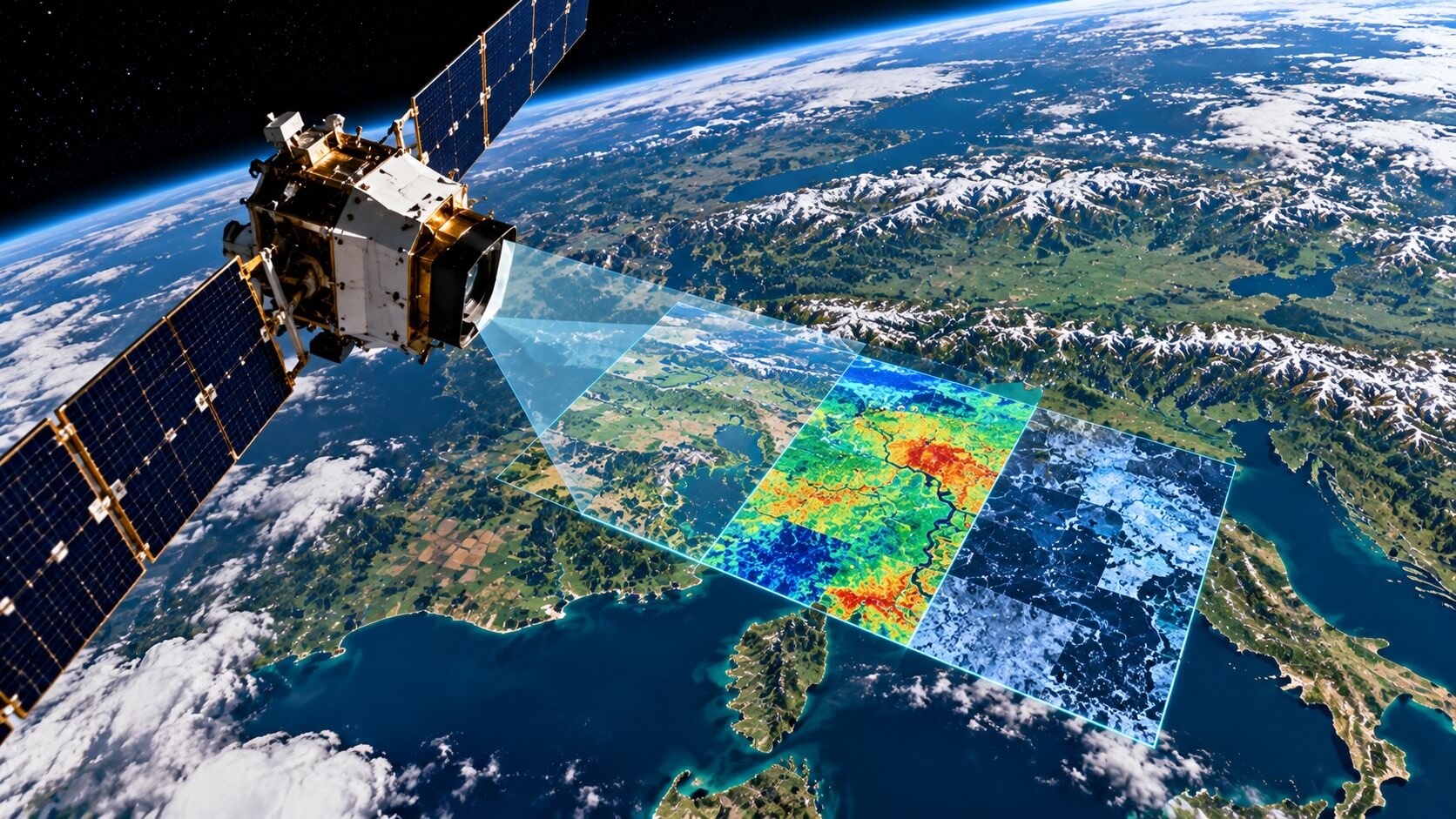
Earth observation is the process of collecting information about our planet using satellites, aircraft, and specialized sensors. It allows governments, businesses, and researchers to monitor weather, agriculture, forests, oceans, cities, and environmental changes without physically visiting every location.
For investors, Earth observation represents a commercial market where satellite technology meets data analytics, artificial intelligence, and real-world business decisions.
Companies use satellite imagery and other observations to monitor supply chains, assess natural disasters, improve agricultural productivity, and identify changes in economic activity.
But the investment opportunity extends beyond the satellites themselves. Much of the potential value lies in turning large amounts of Earth observation data into information that customers are willing to pay for.
The industry also faces challenges, including competition from freely available government data, substantial infrastructure costs, changing satellite disposal requirements, and dependence on public-sector contracts.
Understanding how this industry works is essential for evaluating its opportunities, limitations, and long-term prospects.
What Is Earth Observation?
Earth observation, often abbreviated as EO, refers to the collection and analysis of information about Earth's surface, atmosphere, and oceans.
Although satellites are the most recognizable part of the industry, Earth observation also includes measurements collected by aircraft, drones, ground instruments, and other monitoring systems.
Satellites are especially important because they can observe enormous geographic areas repeatedly, including remote regions that would be difficult or expensive to monitor from the ground.
Earth observation systems can help answer questions such as:
- How quickly are forests disappearing?
- Are crops developing normally?
- Where are floods or wildfires spreading?
- How are cities expanding?
- What is happening to sea ice and ocean temperatures?
- How are industrial facilities and transportation networks changing?
These observations support decisions across government, science, and private industry.
Earth observation is not simply about taking photographs from space. Modern satellites can measure temperature, detect changes in vegetation, observe atmospheric gases, and identify physical changes that are difficult to recognize with ordinary cameras.
This ability to transform measurements into useful information is what makes Earth observation economically valuable.
How Does Earth Observation Work?
Most satellite-based Earth observation systems follow a relatively straightforward process.
First, a satellite collects information using instruments designed to measure specific characteristics of Earth.
Next, the satellite transmits the collected information to receiving stations on the ground.
The information is then processed, analyzed, and converted into products that customers can use.
For example, an agricultural company might purchase satellite-based information showing which fields are experiencing water stress.
An insurance company might use satellite imagery to assess damage following a hurricane.
A logistics company could monitor changes around ports or transportation infrastructure.
The underlying technology can be sophisticated, but the commercial principle is simple: collect information that would otherwise be difficult to obtain and make it useful for decision-making.
Optical Satellites
Optical satellites capture images using reflected sunlight, similar in principle to conventional digital cameras.
They can reveal roads, buildings, agricultural fields, forests, and many other visible features.
However, ordinary optical imagery has limitations. Clouds can block the view, and most visible-light imaging requires daylight.
Radar Satellites
Radar satellites transmit signals toward Earth and measure the returning reflections.
A particularly important technology is synthetic aperture radar, commonly called SAR.
Unlike ordinary optical imaging, SAR can collect useful observations at night and through cloud cover.
This makes radar valuable for monitoring floods, infrastructure movement, shipping activity, and regions where persistent clouds limit conventional imaging.
Thermal and Multispectral Sensors
Other satellites measure information beyond visible light.
Thermal sensors detect temperature differences, while multispectral instruments collect information across several portions of the electromagnetic spectrum.
These measurements can help identify crop health, water conditions, wildfire activity, and environmental changes.
Different instruments serve different commercial purposes, and no single satellite technology is ideal for every application.
How Many Earth Observation Satellites Are in Space?
Earth observation satellites represent a specialized portion of the much larger satellite industry.
Their numbers have expanded as launch costs have declined, smaller satellites have become more capable, and commercial companies have entered markets previously dominated by government programs.
However, there is no single universally accepted count of active Earth observation satellites.
The total depends on how satellites are classified, whether commercial and government systems are both included, and whether inactive spacecraft are excluded.
Some satellites also perform multiple functions, making classification more complicated.
What matters commercially is not only how many satellites exist, but how frequently they can observe the same location and how useful their collected data becomes.
A larger constellation can provide more frequent observations, allowing customers to detect changes faster.
For a closer examination of satellite counts and the industry's expanding infrastructure, see How Many Earth Observation Satellites Are There? A Look at the Growing EO Market.
Earth Observation vs. Communication Satellites: What's the Difference?
Not every satellite orbiting Earth is designed to observe the planet.
Communication satellites transmit information between locations, providing services such as broadband internet, television distribution, and connectivity.
Earth observation satellites primarily collect information about Earth's physical characteristics and activities.
This distinction matters because the two industries operate under different business models.
A satellite internet operator generally earns revenue by selling connectivity.
An Earth observation company may generate revenue through imagery subscriptions, analytical products, government contracts, or specialized monitoring services.
SpaceX's Starlink network is an example of a large communications constellation rather than an Earth observation system.
The expansion of communications constellations has significantly influenced the overall number of spacecraft in orbit.
This means investors should avoid using total satellite counts as a direct measure of the Earth observation market.
To understand the broader satellite population and SpaceX's role in it, read How Many Satellites Orbit Earth Today? And How Many Belong to SpaceX?.
Who Uses Earth Observation Data?
Earth observation serves a much broader customer base than space agencies and scientific institutions.
Its commercial potential comes from providing information that improves decisions in industries already spending substantial amounts on monitoring, forecasting, and risk management.
Agriculture
Farmers and agricultural businesses use satellite data to monitor crop development, soil conditions, and vegetation health.
Repeated observations can help identify areas requiring attention before problems become visible across an entire field.
Satellite information can also support crop forecasting and agricultural insurance.
For companies operating across large geographic regions, remote monitoring may reduce the need for repeated physical inspections.
Insurance and Disaster Management
Insurance companies can use Earth observation imagery to evaluate exposure to floods, wildfires, storms, and other natural hazards.
After a disaster, satellite images may help identify affected areas and prioritize assessments.
However, satellite information does not automatically replace on-site inspections or establish the final value of an insurance claim.
Its main benefit is providing additional information quickly, particularly when access to damaged locations is difficult.
Energy and Infrastructure
Energy companies can monitor pipelines, facilities, and surrounding terrain.
Infrastructure operators may use radar measurements to detect ground movement around roads, railways, dams, and buildings.
Satellite monitoring can complement traditional inspections, especially across extensive networks.
Financial Services and Economic Research
Satellite observations can also provide alternative data for financial analysis.
Alternative data refers to information collected outside traditional financial statements and economic reports.
Examples include monitoring industrial activity, construction progress, agricultural conditions, or activity around major transportation facilities.
Such observations may help investors develop a broader picture of economic conditions.
However, satellite-derived indicators require careful interpretation. A visible change in activity does not necessarily translate directly into higher revenue, profitability, or stock performance.
Governments and Environmental Agencies
Public institutions remain important users and purchasers of Earth observation services.
Applications include weather forecasting, environmental monitoring, emergency response, land management, and national security.
Programs operated by organizations such as NASA, NOAA, the U.S. Geological Survey, and the European Space Agency have helped establish the scientific and operational foundations of modern Earth observation.
Government involvement can create commercial opportunities, but dependence on public contracts also exposes companies to procurement cycles and changing budget priorities.
How Do Earth Observation Companies Make Money?
The Earth observation industry includes several distinct business models.
Understanding these differences is important because two companies operating satellites may have very different revenue sources, operating costs, and financial risks.
| Business model | What the company sells | Typical customers |
|---|---|---|
| Satellite manufacturing | Spacecraft, sensors, and components | Governments, satellite operators |
| Satellite operations | Imagery and collected observations | Government agencies, businesses |
| Data subscriptions | Recurring access to imagery or datasets | Agriculture, insurance, research |
| Analytics platforms | Processed information and decision tools | Enterprises, financial institutions |
| Specialized monitoring | Industry-specific intelligence and alerts | Infrastructure, defense, logistics |
Some companies combine several of these activities.
A satellite operator might collect imagery, process it using artificial intelligence, and sell the resulting analysis through a subscription platform.
Others specialize in software and analytics without owning satellites.
This distinction can have major financial implications.
Operating a satellite constellation generally requires significant investment in spacecraft, launches, ground infrastructure, and replacement capacity.
Software-focused businesses may require less physical infrastructure, although they still face data acquisition costs, computing expenses, and competitive pressures.
For investors, the central question is not simply whether a company operates advanced satellites.
It is whether the company can consistently convert its capabilities into profitable customer relationships.
Which Companies Operate in the Earth Observation Industry?
The industry includes publicly traded companies, privately held businesses, and government-supported programs.
Several companies illustrate how different the commercial approaches can be.
Planet Labs
Planet Labs (NYSE: PL) operates Earth imaging satellites and provides imagery, data, and analytical products.
Its business emphasizes repeated observations of Earth, allowing customers to monitor changes over time.
The company serves commercial and government customers, making it a useful example of the satellite imagery subscription model.
Investors should evaluate customer retention, contract growth, operating margins, and the cost of maintaining and upgrading its satellite infrastructure.
BlackSky Technology
BlackSky Technology (NYSE: BKSY) provides satellite imagery and intelligence services focused on monitoring locations and activities over time.
Its business combines satellite observations with analytical software and monitoring capabilities.
Government and defense-related demand is an important consideration when evaluating this type of business.
In August 2026, NYSE initiated delisting proceedings for BlackSky's warrants under the symbol BKSY.W. The action did not affect the continued NYSE listing of the company's common shares under BKSY.
This distinction matters because a regulatory or exchange announcement affecting one security should not automatically be interpreted as applying to every security issued by the same company.
Satellogic
Satellogic (NASDAQ: SATL) has pursued commercial Earth observation through satellite imagery and related services.
Its approach illustrates both the opportunity and financial challenges associated with developing and operating a satellite constellation.
Investors should distinguish technical ambitions from demonstrated operating performance, contracted revenue, and available financing.
ICEYE and Other Private Operators
ICEYE is a privately held company specializing in synthetic aperture radar satellite technology.
Its capabilities demonstrate the commercial importance of obtaining observations in conditions where optical imagery is limited.
Other privately held businesses participate in satellite manufacturing, imagery processing, environmental monitoring, and geospatial analytics.
Not all important Earth observation companies are publicly traded.
And not every publicly traded space company has meaningful exposure to Earth observation.
Investors therefore need to examine each company's actual revenue sources rather than relying on broad space-industry labels.
Why Is Artificial Intelligence Important for Earth Observation?
Earth observation satellites generate large volumes of information.
The commercial challenge is often not collecting another image but identifying which changes matter.
Artificial intelligence can help automate this process.
For example, software can analyze repeated satellite observations to identify new construction, changes in agricultural vegetation, or activity around industrial facilities.
Instead of asking a customer to examine thousands of images, an analytics platform may deliver a specific alert or measurement.
This creates an important distinction between raw data and actionable information.
Raw imagery may be valuable, but customers are often more interested in the answer it provides.
An insurance company wants to know which insured properties may have been affected by a flood.
An agricultural business wants to identify which fields require attention.
An infrastructure operator wants to detect potentially significant changes before they become expensive problems.
AI can help deliver those answers more efficiently.
However, automated interpretation also introduces risks.
Algorithms can produce false alerts, overlook important changes, or misinterpret incomplete observations.
Human verification, data quality, and the reliability of analytical models remain important.
For investors, the opportunity lies in companies that can demonstrate measurable customer value rather than merely claiming to use AI.
Why Are Governments Investing in Earth Observation?
Earth observation supports activities that are economically important but not always commercially profitable on their own.
Weather forecasting, environmental monitoring, disaster response, and scientific research can provide broad public benefits.
Governments therefore finance satellite programs, purchase commercial data, and support research infrastructure.
National security is another important source of demand.
Satellite observations can help monitor geographic changes, infrastructure, and activities in strategically important regions.
Commercial Earth observation providers may supply data and analytical services to defense and intelligence customers.
At the same time, countries increasingly view space infrastructure as strategically important.
Satellite ownership, launch capabilities, and access to space-based information can influence technological independence and national security.
The geographic distribution of satellite capabilities provides useful context for this competition.
For a comparison of national satellite ownership and space leadership, see Which Country Leads in Space? A Look at Satellite Ownership by Nation.
What Are the Biggest Challenges Facing Earth Observation Companies?
The industry's technological progress does not eliminate its commercial and operational risks.
Several challenges are particularly relevant to investors.
High Upfront Investment
Building and operating satellites requires capital before many services can generate meaningful revenue.
Expenses may include manufacturing, launch services, ground stations, software development, and constellation maintenance.
Companies that expand aggressively without sufficient customer demand may face financing pressure.
Competition and Pricing
Satellite imagery is available from multiple commercial and public sources.
Some government-supported Earth observation programs provide data openly, creating valuable public resources while also increasing competition for certain commercial products.
For example, publicly available Landsat and Copernicus Sentinel data can support research, environmental monitoring, and commercial applications.
Companies must demonstrate why customers should pay for their imagery, analytical tools, or specialized services.
Higher resolution, faster delivery, more frequent observations, and reliable analytics can help differentiate products.
Satellite Lifespan and Replacement Costs
Satellites do not operate indefinitely.
Components degrade, fuel may be depleted, and spacecraft can become technologically outdated.
Operators must plan for replacement satellites and the costs associated with maintaining service continuity.
Satellite failures can also interrupt data collection or reduce the frequency of observations.
The broader history of long-lived spacecraft and satellite failures is explored in The Oldest Satellites Still in Orbit — and the Ones We've Lost.
Space Debris and New Satellite Disposal Rules
As more spacecraft enter orbit, operators must manage collision risks and increasingly crowded orbital environments.
A collision can damage or destroy satellites and create additional debris.
Earth observation businesses must also consider end-of-life disposal requirements and evolving regulatory standards.
For many years, the 25-year guideline served as a widely recognized reference for removing retired spacecraft from protected low Earth orbit regions.
However, satellite disposal standards have become stricter.
The U.S. Federal Communications Commission adopted a requirement for covered spacecraft operating in or passing through low Earth orbit below 2,000 kilometers and planning uncontrolled atmospheric reentry to complete disposal as soon as practicable, and no later than five years after the end of their missions.
The requirement became effective in September 2024, following the FCC's 2022 decision and the applicable transition period.
The European Space Agency also introduced updated debris mitigation requirements that reduce the maximum disposal phase in protected low Earth orbit to five years for covered ESA missions.
ESA's framework additionally emphasizes disposal reliability, collision avoidance, and measures that can facilitate the removal of failed spacecraft.
These requirements do not establish one universal five-year rule for every satellite worldwide.
Different jurisdictions, missions, and orbital regions remain subject to different requirements.
For investors, the practical implications include possible additional spending on propulsion, spacecraft reliability, mission planning, and satellite replacement.
For a detailed explanation of the transition from the traditional guideline to newer standards, see Satellite Reentry Rules Explained: From the 25-Year Guideline to New Standards.
Customer Concentration
Some Earth observation businesses depend heavily on government customers or a relatively small number of major contracts.
Large contracts can provide revenue visibility, but renewals, budget decisions, and procurement delays can materially affect financial performance.
Investors should evaluate how diversified a company's customer base really is.
Is Earth Observation a Good Investment Opportunity?
Earth observation offers exposure to several long-term trends: demand for geospatial information, improved satellite capabilities, AI-driven analytics, and increased interest in monitoring economic and environmental activity.
But industry growth and investment returns are not the same thing.
A market can expand while individual companies struggle to generate profits.
Some businesses may benefit from growing demand yet still require repeated capital raises to finance operations.
Others may develop useful technology without establishing a sufficiently large paying customer base.
A disciplined evaluation should consider several factors.
Revenue growth and customer retention: Are customers purchasing services repeatedly, and is demand expanding beyond pilot projects?
Recurring revenue: Does the company generate predictable subscription or contract revenue, or does it depend on occasional large transactions?
Profitability and cash flow: Is revenue growth translating into improving operating economics, or is the company consuming substantial cash?
Capital requirements: How much additional investment will be needed to maintain or expand satellite operations?
Competitive differentiation: Does the company provide information customers cannot easily obtain elsewhere?
Valuation: Does the stock price already assume exceptionally strong future growth?
Government exposure: How dependent is the business on defense budgets, public contracts, and regulatory decisions?
These considerations matter more than the number of satellites a company launches or the excitement surrounding a new technological announcement.
Investors should also recognize that space-related stocks can be volatile, particularly when companies are small, unprofitable, or dependent on external financing.
How Does Earth Observation Connect to Climate Monitoring?
Earth observation plays an important role in understanding environmental change.
Satellites can help monitor forest cover, land use, sea ice, ocean conditions, atmospheric composition, and the effects of extreme weather.
These observations support scientific research and can inform government and corporate decisions.
For example, repeated satellite measurements can help identify changes in land cover or provide information about the geographic extent of flooding.
Climate-related monitoring can also create demand for specialized data services.
However, environmental importance does not automatically translate into commercial profitability.
Some climate datasets are publicly funded and freely available, while other applications require specialized processing, verification, and customer-specific analysis.
International climate conferences and Earth observation industry events provide opportunities to follow policy developments, scientific priorities, and potential commercial applications.
Events such as the United Nations COP summits focus on international climate negotiations, while specialized conferences organized by space agencies and scientific institutions examine satellite missions, emissions monitoring, and environmental applications.
These events can help investors identify emerging priorities, but their financial significance depends on whether announcements lead to funded programmes, commercial contracts, and recurring demand.
For an explanation of the most important events and what they mean for the industry, see Earth Observation and Climate Conferences: Key Events and Why They Matter.
What Could Shape the Future of Earth Observation?
Several developments could influence how the industry evolves.
More frequent satellite observations. Larger and more capable constellations may allow businesses to monitor locations with shorter intervals between observations.
Better analytical software. Improvements in AI could make satellite information easier to interpret and integrate into everyday business operations.
Greater use of radar technology. Demand for observations that work at night and through clouds may support additional applications.
Integration with other datasets. Combining satellite information with weather data, ground sensors, and business records could produce more useful insights.
Growing demand for specialized monitoring. Customers may increasingly seek specific answers rather than large collections of raw imagery.
Changing regulations and security requirements. Satellite operators will need to adapt to orbital safety rules, data restrictions, and national security considerations.
Improved data accessibility. Cloud-based platforms and more capable analytical tools may make satellite information easier for businesses to use without developing their own space infrastructure.
None of these trends guarantees that every Earth observation business will succeed.
The companies best positioned for long-term success may be those that can combine reliable observations, differentiated analytics, strong customer relationships, and sustainable financial performance.
Why Earth Observation Matters Beyond the Space Industry
Earth observation is increasingly connected to economic activities on the ground.
Its value comes from helping organizations understand changes they cannot easily monitor through conventional methods.
A satellite image becomes commercially meaningful when it helps a farmer manage crops, an insurer evaluate risk, a government respond to a disaster, or a business understand its operations.
For investors, that creates an opportunity to study an industry where space infrastructure, software, and data services intersect.
But the most important distinction is between technological capability and economic value.
Launching satellites is an achievement. Building a business that customers repeatedly pay for is a different challenge.
The long-term investment case for Earth observation will depend on how successfully companies turn information collected from space into dependable, profitable services on Earth.
Disclaimer: This article is for informational and educational purposes only and does not constitute financial or investment advice. Investing in publicly traded companies involves risk, including the possible loss of principal. Conduct independent research before making investment decisions.